
View of Yachats from the beach
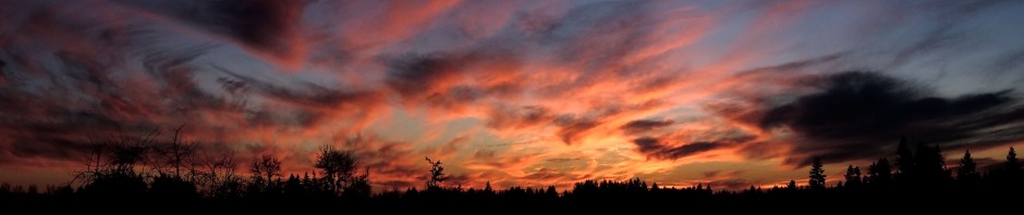
On the first full day of our mini-vacation to Yachats we did quite a bit of sight-seeing. In the early morning we went down to the Yachats beach to catch a view of the town as well as wander about the beach a bit. As we walked we talked about how the beach sand in this part of Oregon was so much different from at our favorite beach in Washington State, Ruby Beach (located almost mid-point on the peninsula). The sand at Ruby Beach is coarser and darker than the sand on the Yachats which is much finer and much lighter in color. The other observation was on the lack of drift logs on those parts of the Oregon coast that we were able as we drove south on Highway 101 to Yachats. This observation was reinforced later in the day when we visited Heceta Beach south of Yachats. The images in this paragraph and the next paragraph illustrate this point (click on the images for a larger view).
Kalaloch Lodge stairway to the beach – thousands of drift logs as you look north
The two beaches we usually visit in Washington, the Kalaloch Lodge beach and Ruby Beach five miles north of the lodge, are covered with drift logs, thousands upon thousands of drift logs all along the beach almost as far as you can see as you look both north and south. At this point you’re probably thinking there’s a little hyperbole going one when I say “thousands” of logs…however, when you click on this image taken in June 2010 when my two sons and I went to the coast, I believe you’ll understand. A picture is one thing but when you see the logs from the top of the steps at the Kalaloch Lodge as you look north it takes your breath away

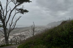
Inlet near the ranger station at Cape Pepetua
After a while we went back to the car and drove a few miles to the National Park ranger station at Cape Pepetua. We stopped for a map of the area as well as to find out more detailed information about Cape Pepetua and to inquire about “Thor’s Well“. The rangers were very knowledgeable and were pleasant to talk with. To the right of the ranger station is a nice view of a trough carved out of the coast line. While we could have walked along the coast line/beach to where Thor’s Well is located, we opted to drive the short distance as we also wanted to visit Heceta Beach further south.
There’s a very nice observation point with good parking when you arrive at Thor’s Well. Once there you can opt to look at the area from the view point or you can walk down well groomed trails from the observation point to the area where Thor’s Well is located. We opted for the walk which was quite nice as it took you through dense vegetation, and a “tunnel” in a Holmes Oak wooded area before you get to the Thor’s Well sign.
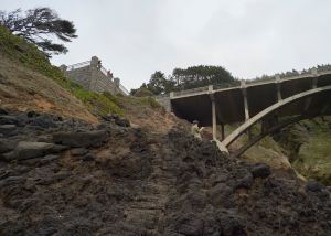
My wife on the path to the right of the Thor’s Well sign. Note the observation point on the right of the bridge – there’s also one on the left side
Once you go down the steps you can go either left to where Thor’s Well is or go right which leads you to a very narrow path that allows a better look at the channel which goes under the road.

Waves cresting where the channel narrows directly below me
As my knee is still in recovery mode I elected to wander around the area in front of the sign. It’s an interesting view as you can watch the waves crest where the channel narrows as they rush in from the ocean.
Just as the rangers told us when the tide is out, there is no “action” in Thor’s Well. While the walk was nice and the terrain was truly fascinating by itself, the real bang for the buck if you want to see what happens with Thor’s Well and the Spouting Horn is when it’s high tide, especially high tide during a storm. More on that to come in a later post.

The site where a CCC cabin used to be
As high tide wasn’t going to be until 9:00 in the evening, we headed back to the car for the drive to Heceta Beach. We returned on a different portion of the path which passed by a site that used to be a barracks for Civilian Conservation Corps men when they worked on the trails and roads in the 1930s.
Next…Heceta Beach

Pingback: November 23, 2015: The Oregon Coast – Part V, Thor’s Well | The Pickled Photographer's Blog